Target Location
The second transmission will display the requested target location fields from the 1st transmission. Observer will enter data and when complete, transmits by clicking the ‘Transmit’ button.
- Target location. There are three methods to specify the location of the target.
-Window.png)
∆ Image 4c: Target Location (2nd Panel) Window |
- Grid. This allows the specification of the eight-figure grid reference of the target, as well the target altitude (m).
Note:
The altitude of the target is in meters above sea-level (not above ground level). If the altitude field is left blank, the altitude of the gun line will be used as default. The From Map button allows the users to select the position from the VBS2 2D map by just clicking on the required location.
When clicked on the from map button, VBS2 will move to the 2D map view. Then users can select a desired position of the VBS2 2D Map. The grid location of that position will be automatically entered to the Grid Text box.
-Window_2.png)
∆ Image 4d: Target Location for Polar & Laser Polar (2nd Panel) Window
- Polar and Laser Polar. The user may use a direction and distance from their position to specify the target location. Note: it is important to send a current and correct Locstat to VBS2Combined Arms before sending polar data. To send a polar mission, first enter the direction from the observer to the target in mils, followed by the observer’s distance to the target in meters. There is the option of also specifying an up or down adjustment relative to the observer’s position in meters

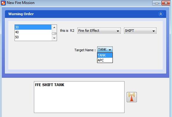
∆ Image 4e: Target Selection for Shift (1st Panel) Window
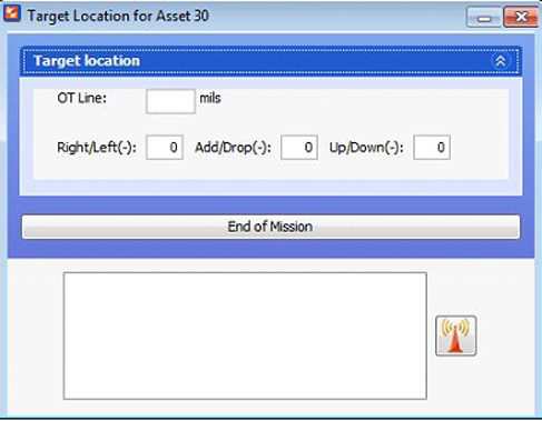
- Shift. If a target has been previously recorded or added by the user to the Asset Target Worksheet, it can be used as a reference point. To do this, select the desired target from the drop down list. When the second transmission appears enter the direction from the observer to the target in mils. The user may also specify an adjustment off the previously recorded target by using the next set of fields. Right / left is the deviation from the target in meters, positive number is a right deviation and negative is a left deviation. Add / drop is a range correction from the target in meters, positive number will adjust the round farther away, a negative number will adjust the round closer. Up / down is a vertical adjustment in meters, positive is an up adjustment, negative is a down.
- Polar and Laser Polar. The user may use a direction and distance from their position to specify the target location. Note: it is important to send a current and correct Locstat to VBS2Combined Arms before sending polar data. To send a polar mission, first enter the direction from the observer to the target in mils, followed by the observer’s distance to the target in meters. There is the option of also specifying an up or down adjustment relative to the observer’s position in meters

∆ Image 4f: Target Location for Shift (2nd Panel) Window |
